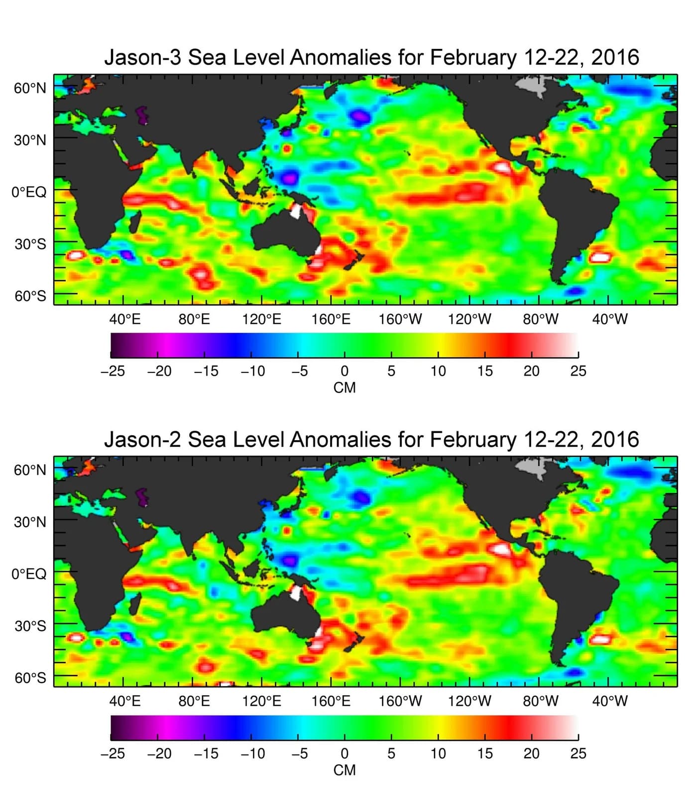
NASA's Earth Observatory has looked at how this year's El Niño compares with the most powerful events on record. It uses a continuous run of ocean-height measurements that radar altimeters have collected from orbit since the early 1990s.
The record began with TOPEX/Poseidon and was carried on by Jason-1, Jason-2, Jason-3 and Sentinel-6 Michael Freilich. Because warm water expands, a bulge of higher sea level across the equatorial Pacific is a clear sign that El Niño heat is building and moving east toward the Americas.
Putting maps from different years side by side lets scientists see how the size and pattern of the current anomaly compare with landmark events such as 1997–98 and 2015–16. Those two episodes brought major disruptions to rainfall, fisheries and temperatures around the world.
According to NASA, an unbroken 35-year record matters because it allows each new El Niño to be judged against a consistent baseline rather than against scattered observations. That makes it easier to judge how unusual an event is and what it may mean for weather and climate.